Tunabreen
Tunabreen (August 2015)
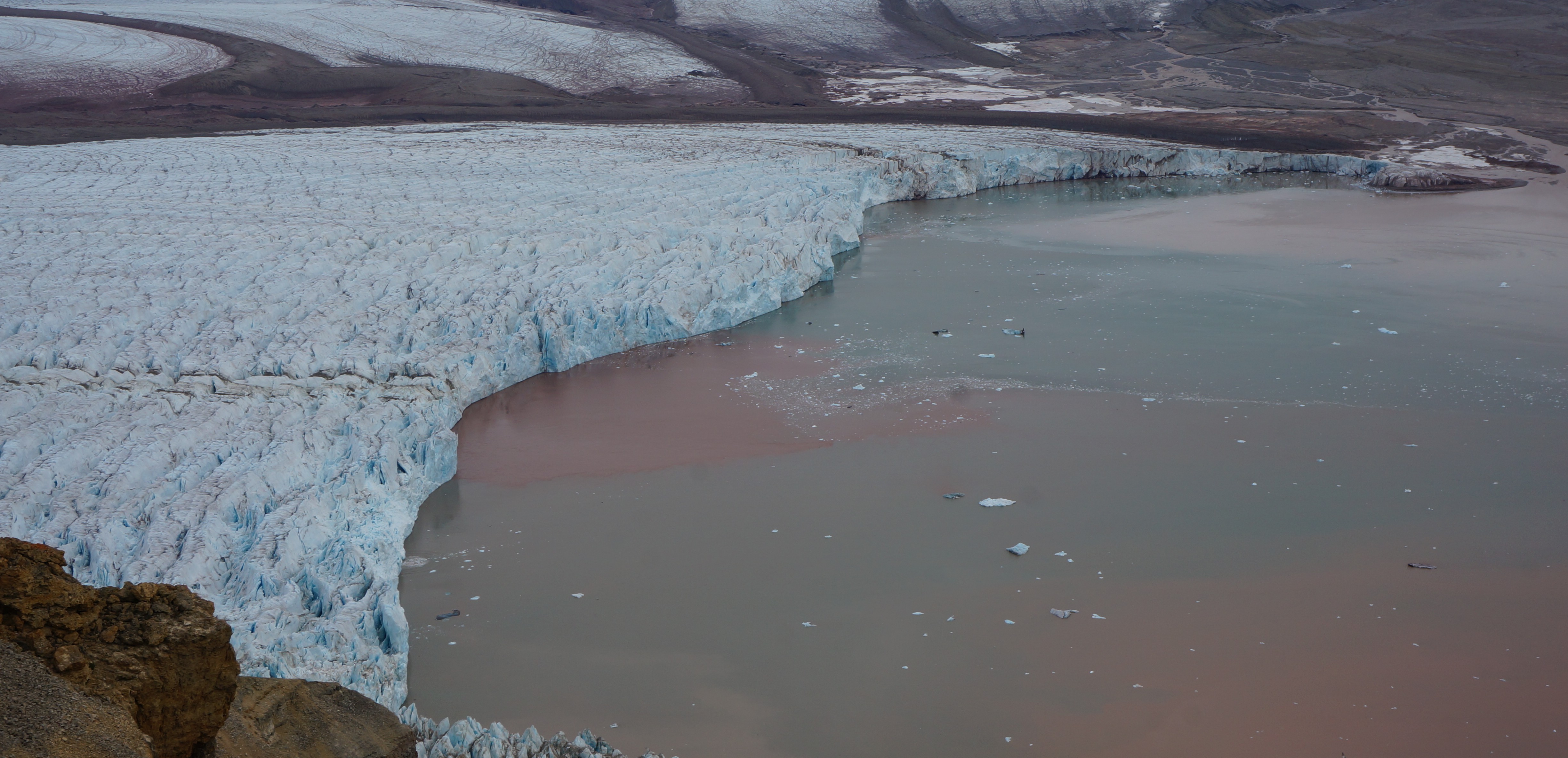
Tunabreen is an ocean-terminating glacier on the west coast of Svalbard, which is special due to its unique set of dynamics. A high proportion of the glaciers in Svalbard are known as surge-type glaciers, meaning they undergo periods of fast-rate advances followed by very slow, inactive phases. Tunabreen is not only a surge-type glacier, but is one of few glaciers in Svalbard to have been observed to undergo repeated surge cycles. It has surged in 1870, 1930, 1971, and between 2002-2005. With each surge, the glacier has been advancing less and less into Tempelfjorden, as there is less mass from the upper part of the glacier to draw downwards. The glacier front advanced around 1.4km into the fjord during the recent 2002-2005 surge, compared to 3km during the 1930 surge. Pronounced ridges on the seabed at Tempelfjorden define these surge extents (Flink et al., 2015).
Much is still to be understood at Tunabreen. Little is known about what is driving the calving dynamics at the front, and what influence upglacier processes have. It is difficult to find answers from one set of data measurements, as they only investigate one portion of the active processes. For two weeks in August 2015, a collaborative fieldwork effort was made to capture data over multiple platforms:
1. The subaerial calving front of Tunabreen was surveyed using laser scanning and photogrammetry by Antonio Abellan (University of Lausanne, Switzerland) along with his students from the University of Lausanne, Switzerland. These produced fantastic profiles of the glacier front over several days.
2. Riko Noormets (UNIS) and Nina Kirchner (Stockholm University), along with UNIS PhD students Anne Flink and Oscar Fransner, were using multi-beam bathymetry, which was mounted on the front of the boat. Unlike their previous work, which primarily looks at the sea bed landform features, the multi-beam was carefully tilted to survey the subaqueous sections of the glacier front, yielding some excellent profiles and distinguished plume origins.
3. Strain meters were placed on the upper section of the glacier surface, where cracks were beginning to appear. It is hoped that these strain meters will capture crevasse propagation, which will relate to what is happening at the front of the glacier. These strain meter units were designed and built by Alberto Behar, consisting of a measurable length of wire stretched over noted cracks and secured to poles.
4. Two custom-built quadcopters were flown over the glacier front with rapid photography capture and a laser range finder to gain overhead 3D surface elevation models. These nicely fit with the photogrammetry work on the subaerial calving front.
5. Water readings and samples were taken from the immediate fjord area to examine plume dynamics and fjord circulation patterns. This involved numerous man hours in a small zodiac boat using numerous probes to take difference water measurements. This work was lead by Kristin Schild (Dartmouth College, New Hampshire, USA), with the assistance of Doug Benn and myself. Kristin was very focused and driven to cover as much of the fjord as possible. Even the loss of a secchi disc could not de-road this work, and a new disc was made from a dvd (the film Twilight…so no big loss) and white and black electrical tape!
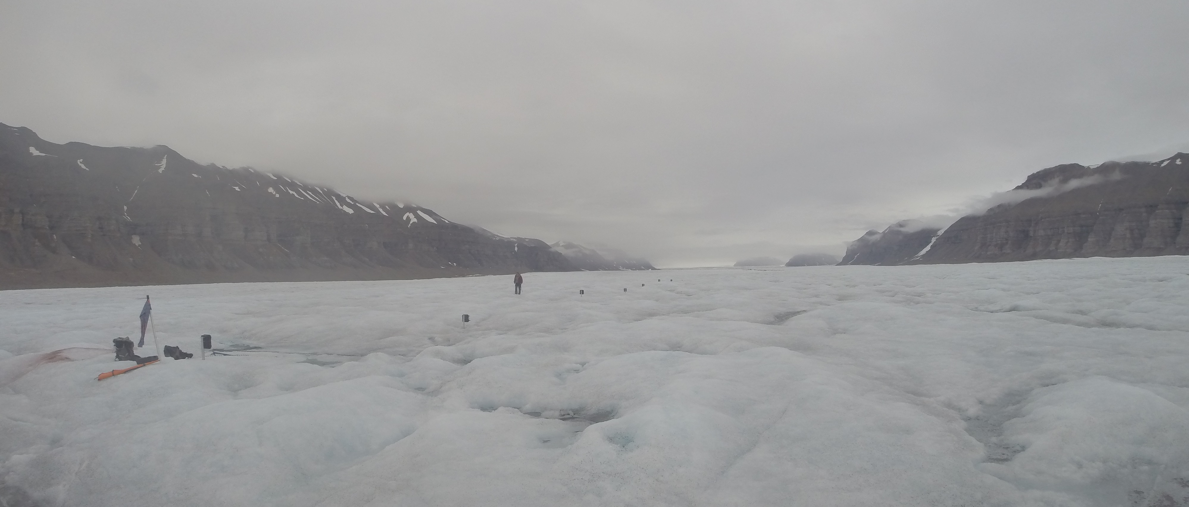
The strain meters installed at Tunabreen this summer
6. Four time-lapse cameras were installed on Ultunafjella, the ridge to the west of Tunabreen. An 85mm lens was focused on the strain meters to additionally monitor crevasse propagation and upglacier dynamics. Two cameras with 50mm lenses were placed in stereo lower down glacier, with the intention to gain stereoscopic velocities and calving rates. And finally, one camera was focused on the calving front and immediate fjord area, and set to take rapid-fire images (one every 3 seconds) to examine calving behaviours and fjord circulation dynamics over 24 hours. These camera systems were designed and produced by the University of Edinburgh School of GeoSciences workshop, and installed by Doug Benn and myself, with the help of Anne Flink, Chris Borstad, Dorothée Vallot and Kristin Schild.
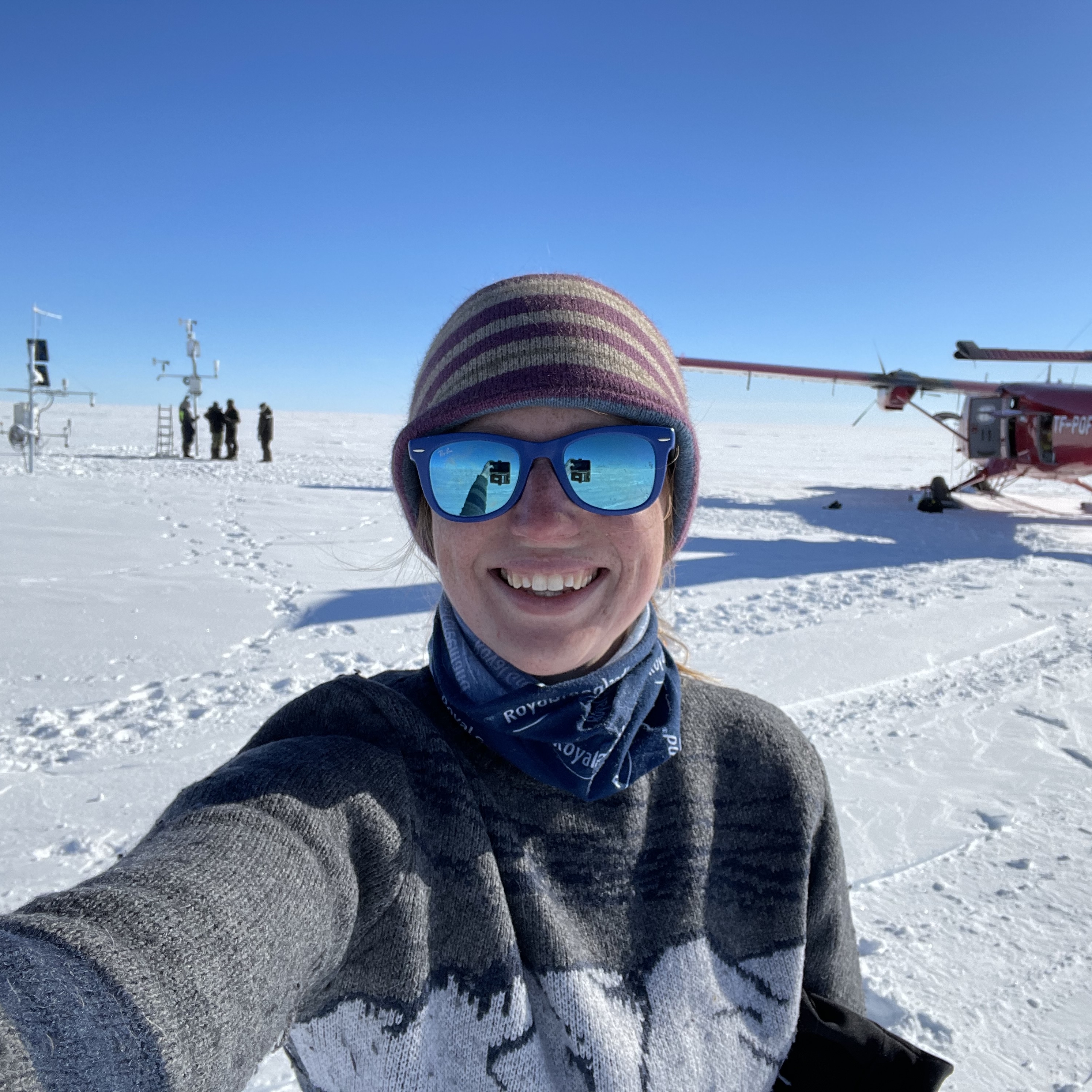
The fieldwork was undertaken over the course of two weeks in August. Unlike in the winter where we can access Tunabreen via snow scooter, the glacier has to be accessed via boat in the summer. Our boat was UNIS’ own, the Viking Explorer, which is a small converted fishing boat with 4 beds. For 2 weeks, we slept, ate and worked on/from the boat (I slept under the kitchen table one week, and under the skipper’s chair the next week… which was surprisingly not as uncomfortable as you might think!) We spent 3 nights moored in Tempelfjorden for the first week, and 5 nights in the second. This was the easiest way to access the glacier on a daily basis.
Access to the glacier and the ridge each day involved long hikes in with heavy packs of equipment. Minor teething problems with the strain meters meant it took us three days in total to install the seven strain meters, drilling poles into the ice and mounting the meters onto them. The ridge that the cameras were installed on took approximately four hours to climb, which we accessed via Brucebreen, a small valley glacier which is situated on the other side of the ridge and Tunabreen. This site was re-visited in the second week to check each camera was working and change the timing of the camera on the calving front from 3 seconds to 10 minutes.
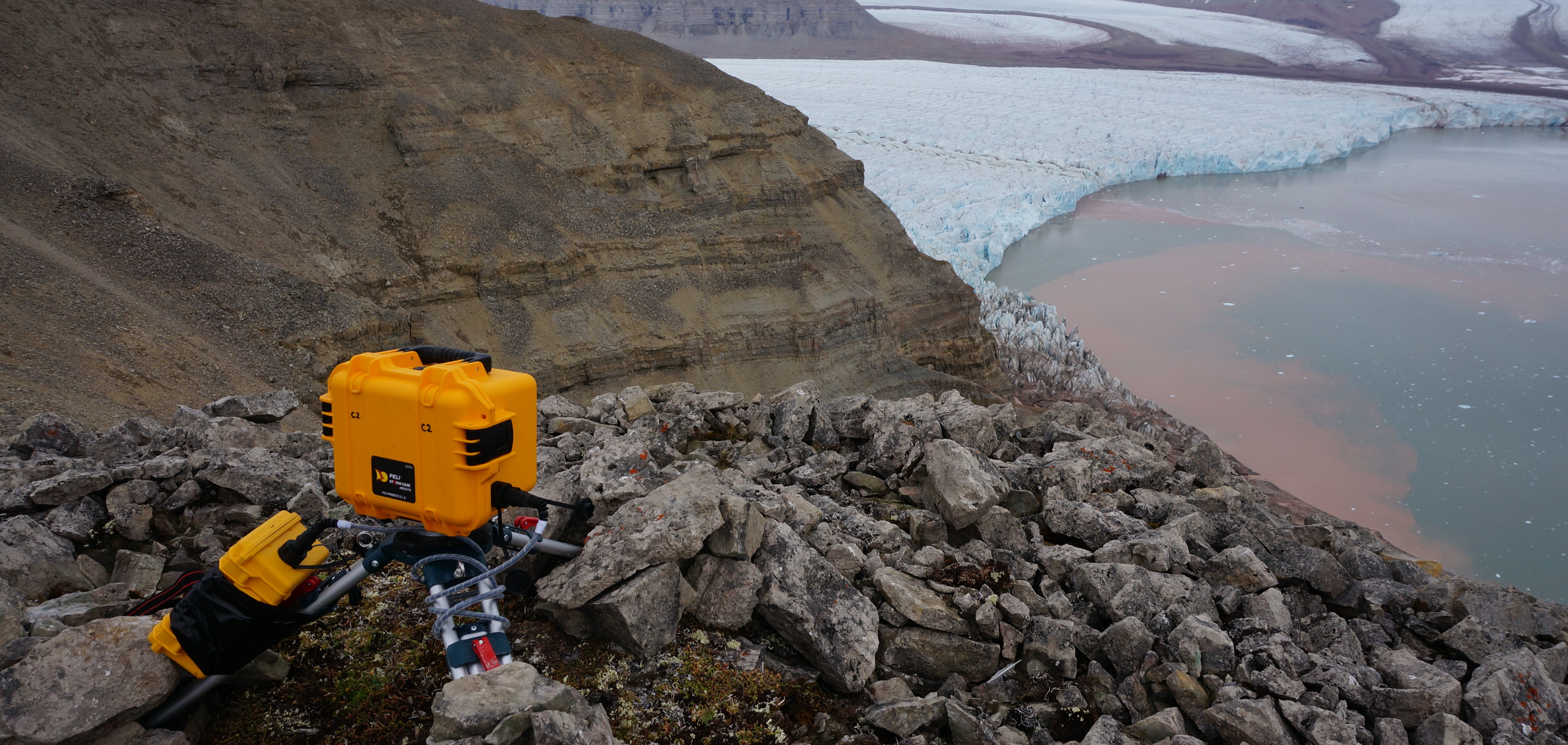
Camera 2 installed at Ultunafjella, overlooking the calving front of Tunabreen (August 2015)
As well as provide better understanding of the dynamics at Tunabreen, it is hoped that this data will also be used as a more realistic domain for mathematical modelling. Early results from the time-lapse installations have given valuable data about the fjord circulation patterns, and there is excited talk of extending our rapid-fire time-lapse applications. It is hoped that the surface model representations from the UAV, laser surveying, photogrammetry and bathymetry work can all be used together to create a complete three-dimensional reconstruction of the glacier front (subaqueous and subaerial). Results so far look very promising.
The general consensus is that this work is something very special. The collaborative effort by all makes this work so rewarding, and being able to bounce ideas off a large group from different academic backgrounds is exciting. I personally feel that the involvement of others and their encouragement makes such fieldwork so much more enjoyable than going it alone.
With thanks to our skippers, Kenneth and Lars Frode, for making this fieldwork possible.
Further reading
Flink et al. (2015)
- Work from UNIS on surveying the sea bed of Tempelfjorden using multi-beam bathymetry, which revealed past surging extents
Sevestre and Benn (2015)
- A new record of surge-type glaciers in the world along with a new uniting theory that explains their distribution – the enthalpy cycle model