PhD Update: September 2016
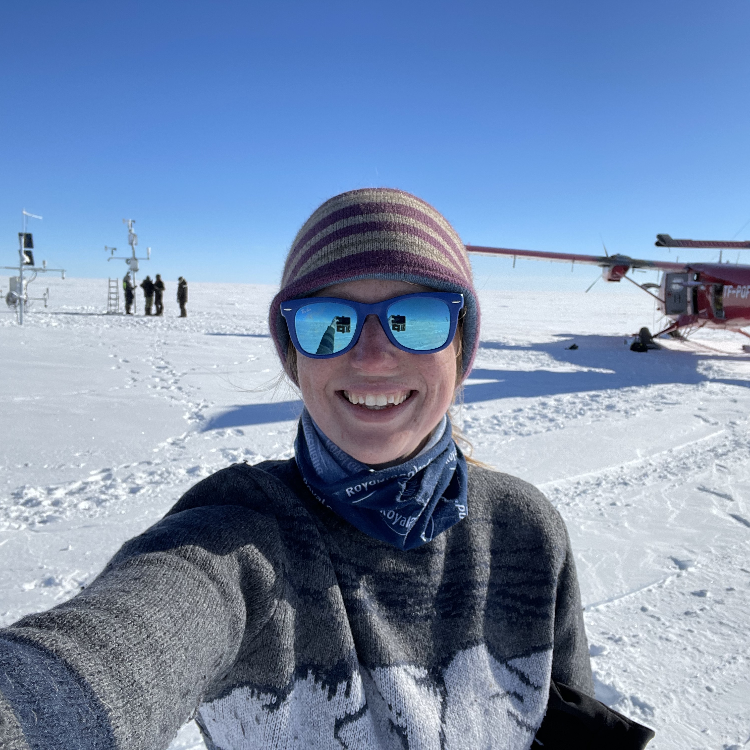
I have been in Svalbard (again) for most of September, collecting images from our 14 time-lapse cameras that we have based in Kongsfjorden and Tempelfjorden. We haven't seen these cameras since May 2016 (Kongsfjorden cameras) and August 2015 (Tempelfjorden cameras) so it was quite nerve-racking to go back and see if everything had worked. We had a couple of disappointments but generally the retrieval was a success, with approximately 130,000 photos collected in total.
Ten time-lapse cameras were deployed in Kongsfjorden last May (click here for more info on the deployment). Eight of these were installed on Collethøgda, overlooking Kronebreen, a fast-flowing marine-terminating glacier at the end of the fjord. It is hoped that the close array of images from these cameras can be used to generate three-dimensional time-lapse sequences using a technique called Structure-from-Motion (SfM) which uses images from multiple angles to generate 3D point clouds of a target.
The other two cameras were installed by Kongsbreen and Kongsvegen, the two glaciers adjacent to Kronebreen. The data from these cameras form part of a longer-term project to monitor glaciers in the Kongsfjorden area. It was of particular importance to the influence of submarine melting on glacial retreat in this area.
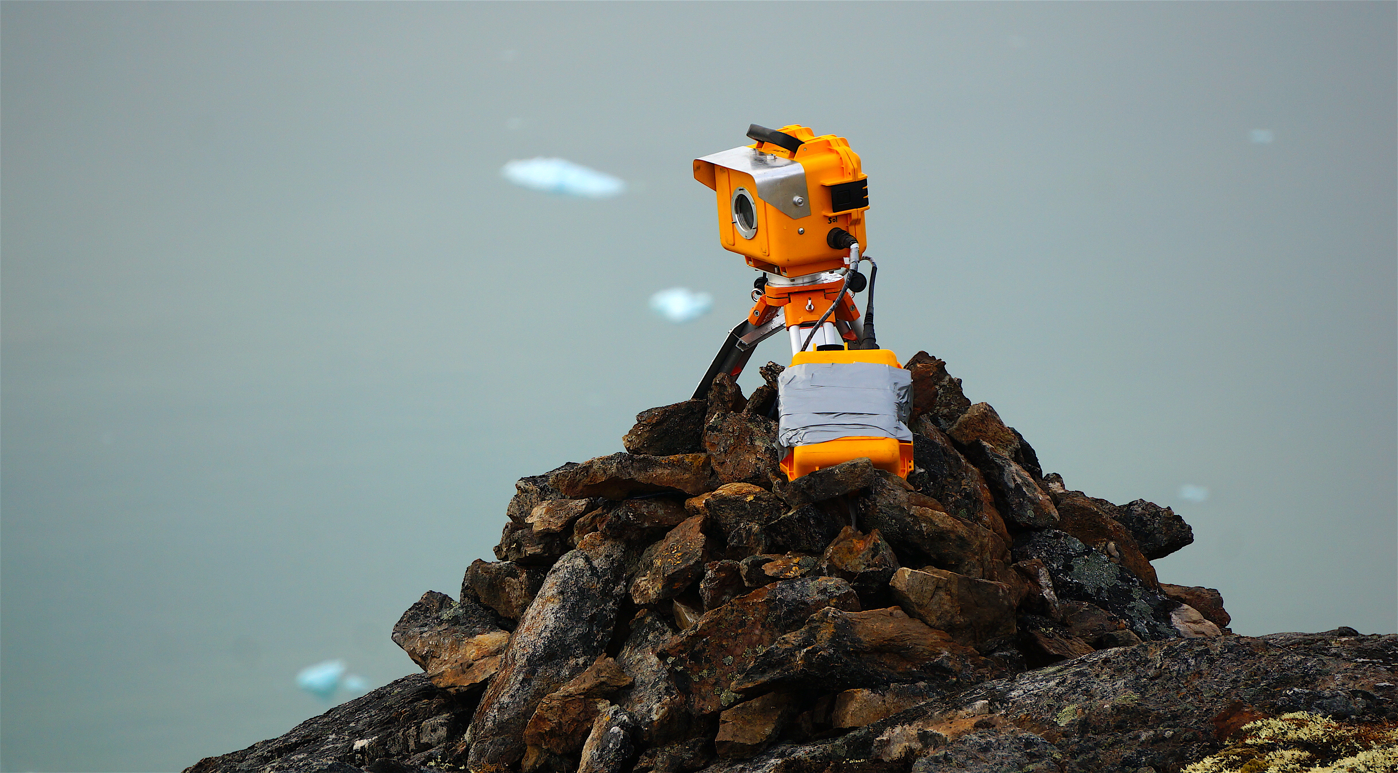
Our camera at Kongsbreen… survived and still working! When were first started installing cameras in Svalbard, we would bolt them into the bedrock and use guide wires to stabilise them. Over time we have learnt that building cairns around the tripod legs is just as effective and takes much less time. We had a particularly long time around this camera site in May to build a large cairn… and do some sunbathing.
Due to bad weather, it proved difficult to access the camera sites and were limited to only two days of helicopter time to retrieve data. We had hoped to have enough time to survey and maintain each of the cameras so that they could run over the winter season, but alas! that is the beauty of fieldwork - you have to work with the weather you have. We managed to retrieve all of the memory cards from the cameras in the end, but couldn't complete the camera surveying.
Previously we had deployed 7 time-lapse cameras in 2014 and 8 cameras in 2015, so we knew we were being ambitious with 10. In total, 6 worked through the entire season collecting images either every 10 minutes or every 30 minutes. We have had better success in the past (5/7 in 2014 and 6/8 in 2015) so we were a little disappointed that we weren't able to beat our personal best! All of the problems were related to the power supply - temperamental solar controllers did not recharge the batteries from the solar panels, and there were poor connections in the camera boxes that had developed over the duration in the field.
Overall, 48 000 images were collected from the cameras at Kongsfjorden - we have a good sequence from Kongsbreen showing multiple submarine plumes creating inlets in the ice front, good coverage over the front of Kronebreen to look at calving activity and surface velocities over the summer season, and a good sample dataset to begin looking at constructing 3D SfM time-lapse sequences.
As the weather was so limiting on our helicopter time, we also accessed the shoreline next to Kronebreen by boat, where we set up our 4K video camera (left over from the CalvingSEIS project last month) to record calving activity. We recorded an 11-hour 4K video sequence which provides some awesome close-ups on isolated calving events such as the one in the video below.
This work is so important to ensure the safety of tourists and scientists alike. Currently the minimum safe distance from a calving front is 200 metres, but accidents do still happen. The distance that ice can be thrown from a calving event is thought to be controlled by the height of the calving origin and the impact with the water. With this in mind, the minimum safe distance should be different for each calving glacier front in Svalbard. We hope that we can track projectiles from such calving events in this sequence to re-assess the distance that boats should be from calving glacier fronts in Svalbard. It is likely that glacier calving fronts require different categories of risk based on calving activity (frequency and volume), ice cliff height and ocean temperature.
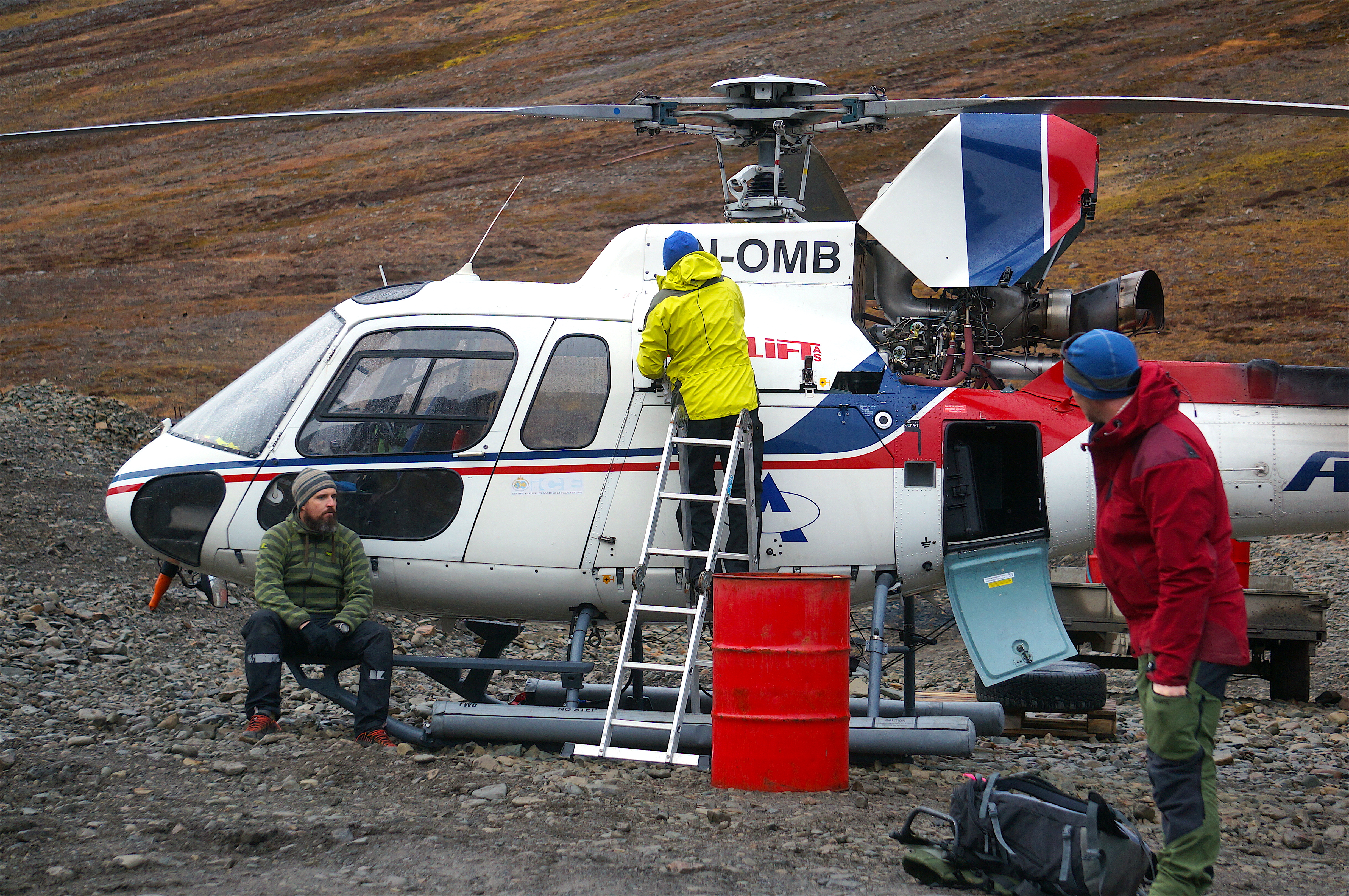
Preparing for our helicopter ride over to Tunabreen. Mats (pilot, left) is ‘composing himself for the flight’ whilst Harold (technician, centre) is doing routine checks on the helicopter. Chris Borstad (UNIS, right) joined us on this trip to check the time-lapse cameras and survey the glacier surface using a laser scanner to look at crevasse propagation rates in the upper section of the glacier tongue.
After finishing in Kongsfjorden, we flew back from Ny Ålesund to Longyearbyen and got a lucky opportunity to fly to Tunabreen and collect data from 4 time-lapse cameras that have been there for over a year now (see here for information on the installations and other work in this area). They were meant to be collected in September 2015, but the plan had to be abandoned due to poor weather. We also planned to retrieve them at the beginning of this year, but the warm winter had left Tempelfjorden first without sea ice for snow scooter transport and then with too much sea ice for the boat season.
After some manic negotiations with the Sysselmannen (Governor of Svalbard), we got permission for two helicopter landings on Ultunafjell, where the time-lapse cameras were installed. When flying over, it was impressive to see how much the calving front has changed, even over the past couple of months. Normally there is one consistent submarine plume at the west side of the calving front (near to the camera in the image below) that is active throughout the melt season, creating an inlet in the calving front. This year though, it appears that a second strong plume at the east side of the calving front has created a marked inlet (see far inlet in the image below). The upper section of the glacier tongue has also changed, with the crevasse field extending much further up-glacier than in previous years. Both the growth of the crevasse field and the change in submarine plume activity could indicate a change in the subglacial conditions at Tunabreen.
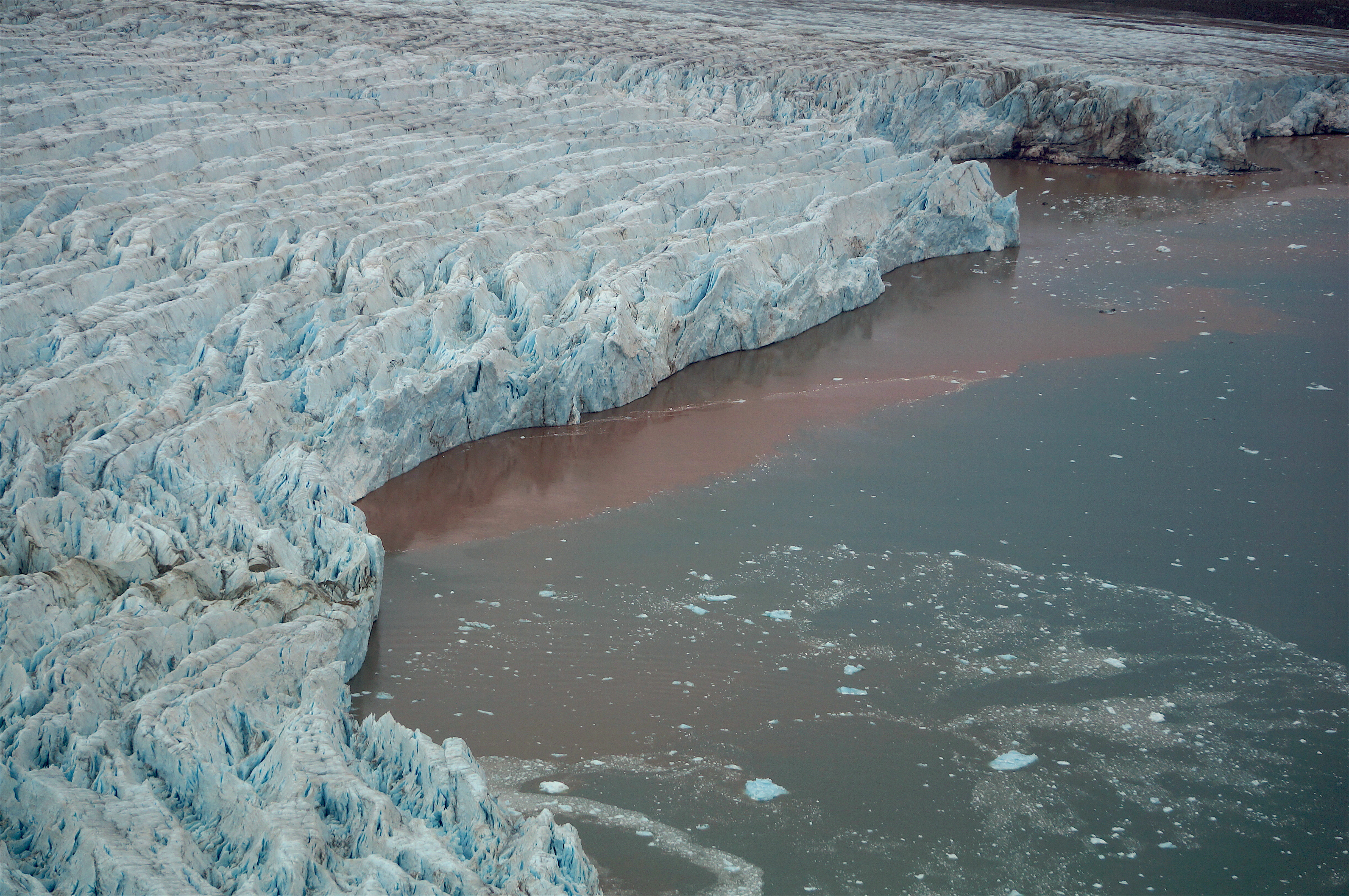
The calving front of Tunabreen. The muddy water in front of the glacier is where the submarine plume has been strong enough to entrain sediment from the sea bed to the surface through turbulent mixing of freshwater and seawater. This promotes melting of the ice below the waterline, which has created two inlets in the calving front this year - the first is closest to the camera with a very visible plume adjacent, the second is the marked bay on the far side.
Three of the cameras on Ultunafjell were entrained on the calving front and lower section of Tunabreen, all of which had captured images till now. Unfortunately, due to unknown circumstances, two of the cameras were taking images that were out of focus when they came back on in the spring (after hibernating over the winter). It is likely that either someone has been up there, taken a look at the cameras and accidentally knocked the focusing ring on the lenses; or that high winds caused vibrations in the camera box that gradually shifted the focusing ring.
It's a new set of circumstances for us anyway! From now on, we will fix the focusing ring in position by taping each lens. Luckily, one camera did not experience focus drift so we have three sets of images from August till November 2015, and one set of images from May to September 2016. This is plenty to work with and will give us a nice dataset to extract velocities and calving rate from.
The fourth camera is positioned further up the ridge, looking at the upper section of the glacier tongue where crevasses are begin to form and propagate. It was installed to monitor an array of strain meters that were set out on the glacier surface, measuring the rate at which crevasses were opening and the rate of longitudinal stretching. The relative distance between each strain meter in the images can be used to ensure that the strain meters are accurately measuring changes at the glacier surface. This camera has captured images every 10 minutes from August 2015 till September 2016, which is a great success. The camera has been surveyed and will now continue to take photos through the rest of 2016 into 2017, providing a complimentary dataset for Chris Borstad and the University Centre in Svalbard (UNIS) to use with other on-glacier instruments.
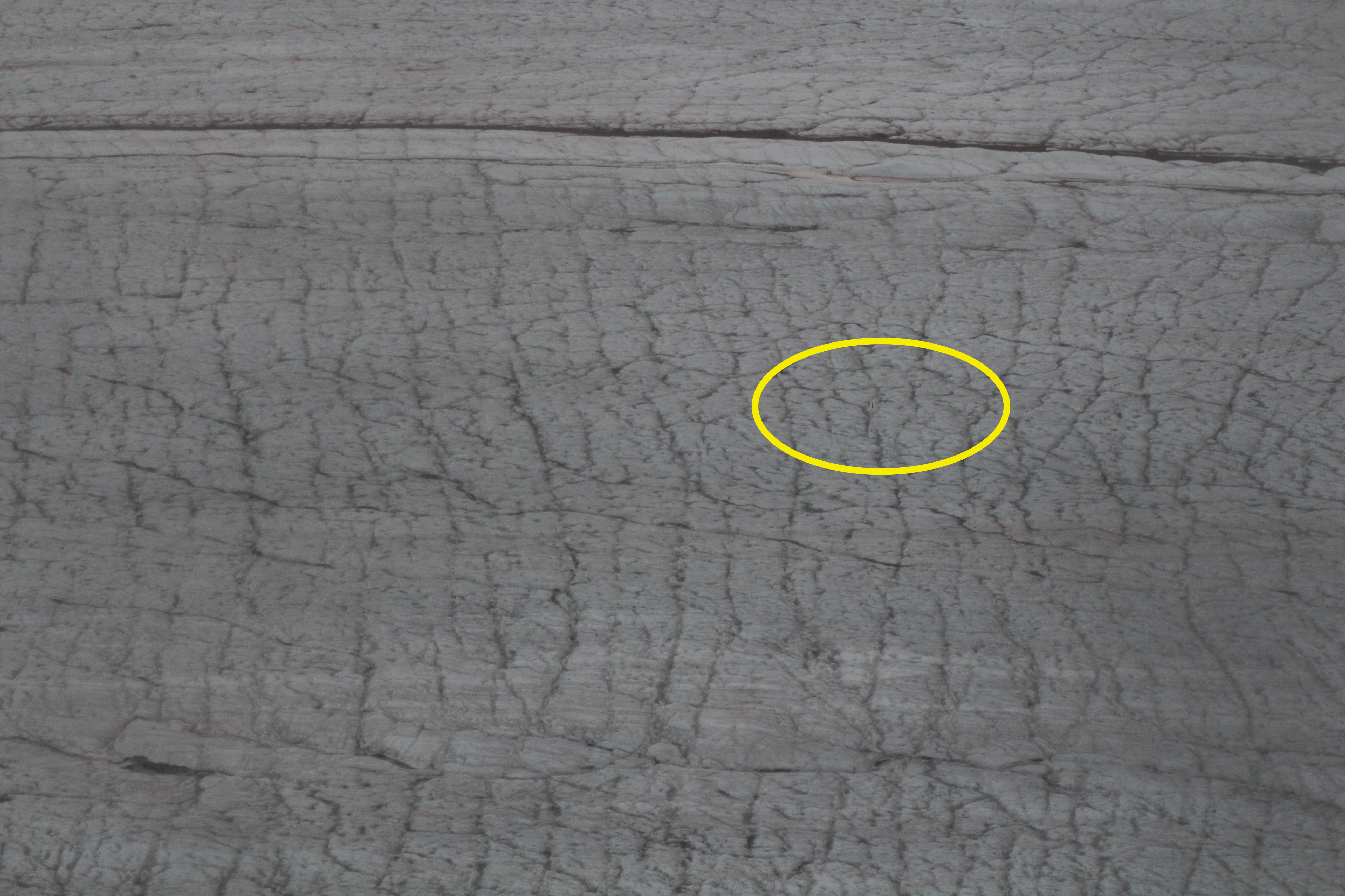
Sample image from the time-lapse sequence at the upper section of Tunabreen. These images monitor an area that is 497.6 m x 331.7 m. The strain meters are difficult to find in this image, with each strain meter box only represented as a 2 x 2 pixel square!
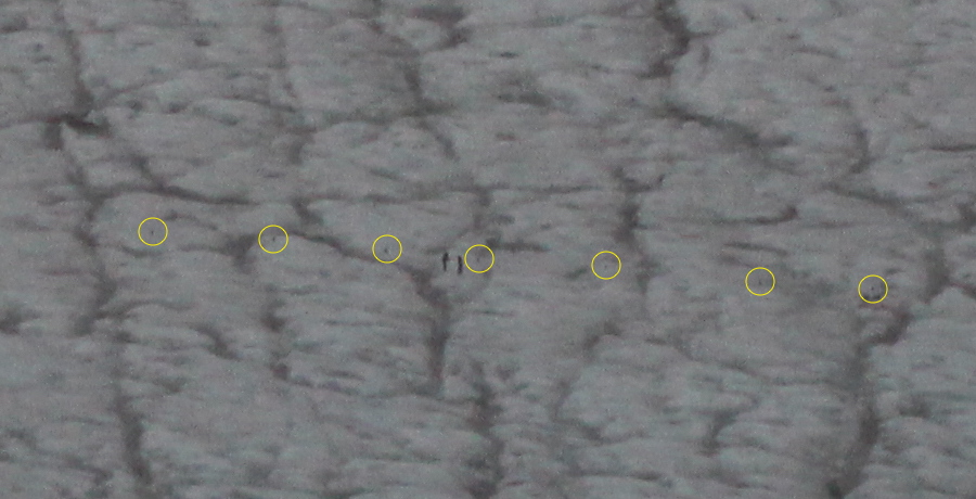
A close-up of the strain meters. The people in the image are myself and Doug Benn, part of the team that installed the seven strain meters on Tunabreen in August 2015.
So, in total, we have collected approximately 130,000 images in this month, providing us with a third consecutive year of time-lapse data at Kronebreen, and new insights into processes at Tunabreen and Kongsbreen. From these images, we should be able to extract a record of surface velocities, calving rate, submarine plume activity and crevasse propagation from each glacier. I am now back from Svalbard for this rest of this year to begin processing this data and enjoy Edinburgh in the autumn/winter season.
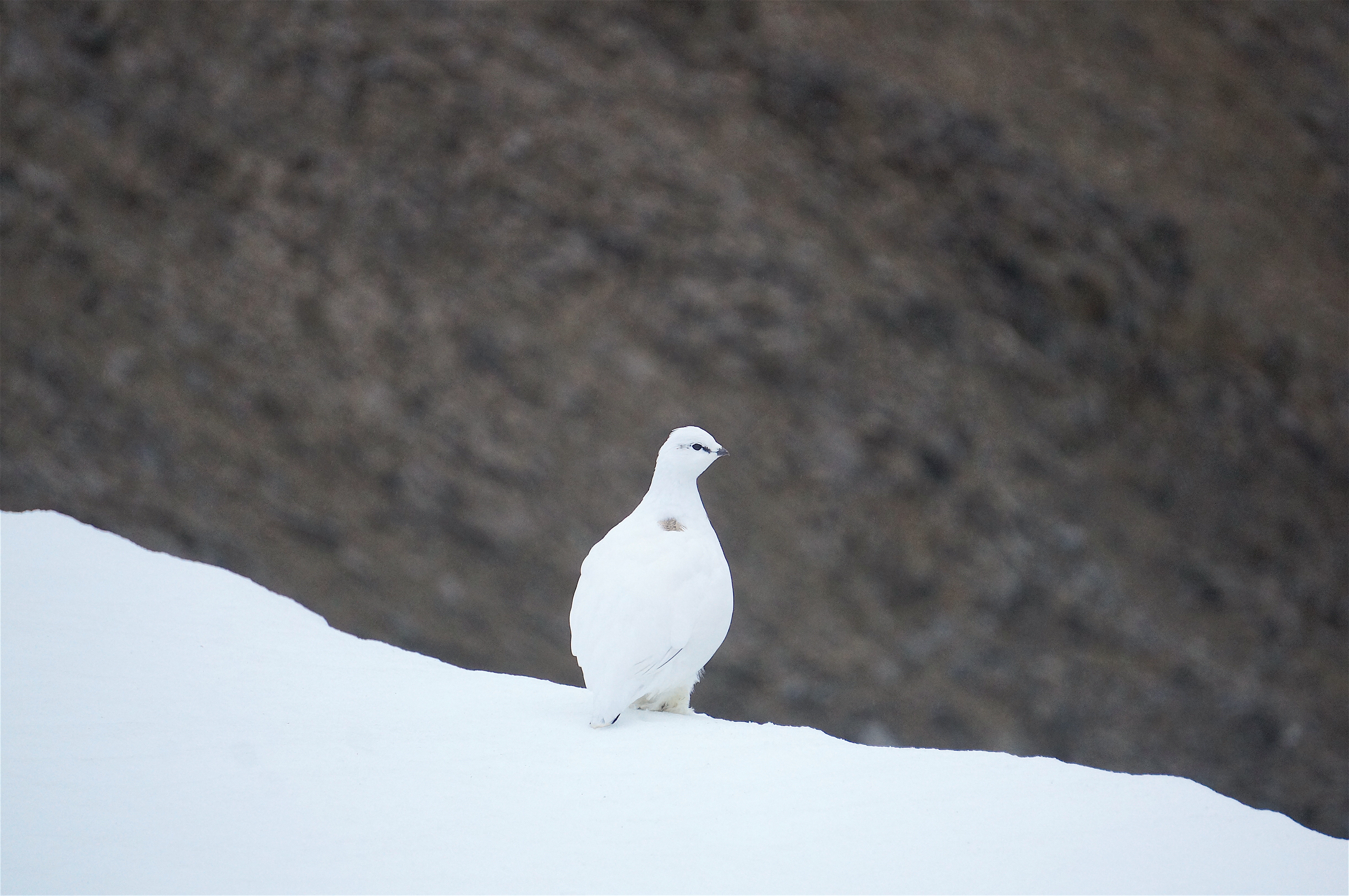
A ptarmigan at Tunabreen. This little guy was walking along with me to visit our third time-lapse camera. Ptarmigans often nest around our cameras at both Tunabreen and Kronebreen - this makes for lovely images, but is a hinderance for photogrammetry processing!
With thanks to the following for making this fieldwork possible: Richard Delf (University of Edinburgh), Jack Kohler (NP), Chris Borstad (UNIS), our helicopter pilots Mats Larsen and Harold Edorsen, our skipper Wojtek Moskal, and all in the NP Sverdrup station in Ny Ålesund.