Space Intelligence
I was hired by Space Intelligence in 2018 to write a series of articles as a guest contributor on the role of remote sensing in monitoring environmental change. This included an introduction to remote sensing for non-scientific audiences, the importance of traceability in palm oil production, and an examination of known Unilever-associated palm oil mills with deforestation. Links to the full articles are provided below:
An introduction to active remote sensing for environmental monitoring
Unilever releases locations of palm oil mills in a bid for supply chain transparency
Unilever palm oil mills locations and comparisons to forest change
The articles attracted much attention to Space Intelligence, including interactions from individuals within Unilever and Greenpeace.
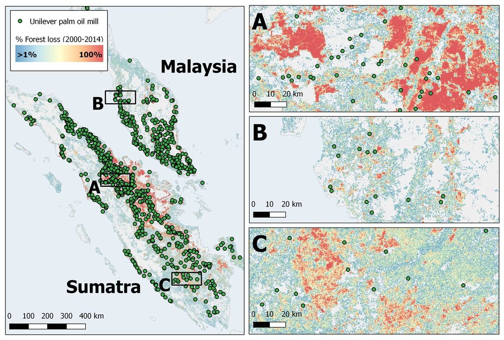
A map of forest loss in Sumatra and Malaysia in comparison to the presence of Unilever-associated palm oil mills. I made this figure for use in one of my articles on palm oil production impact on the tropics. Specifically areas outside the two main cities in Sumatra, Dumai (Map A) and Palembang (Map C), have experienced a high percentage forest loss in recent years, as indicated by the widespread red patches. The district state of Penang (Map B) in Malyasia has experienced markedly less forest loss in comparison, with fewer red patches and many more white regions.