Paulabreen
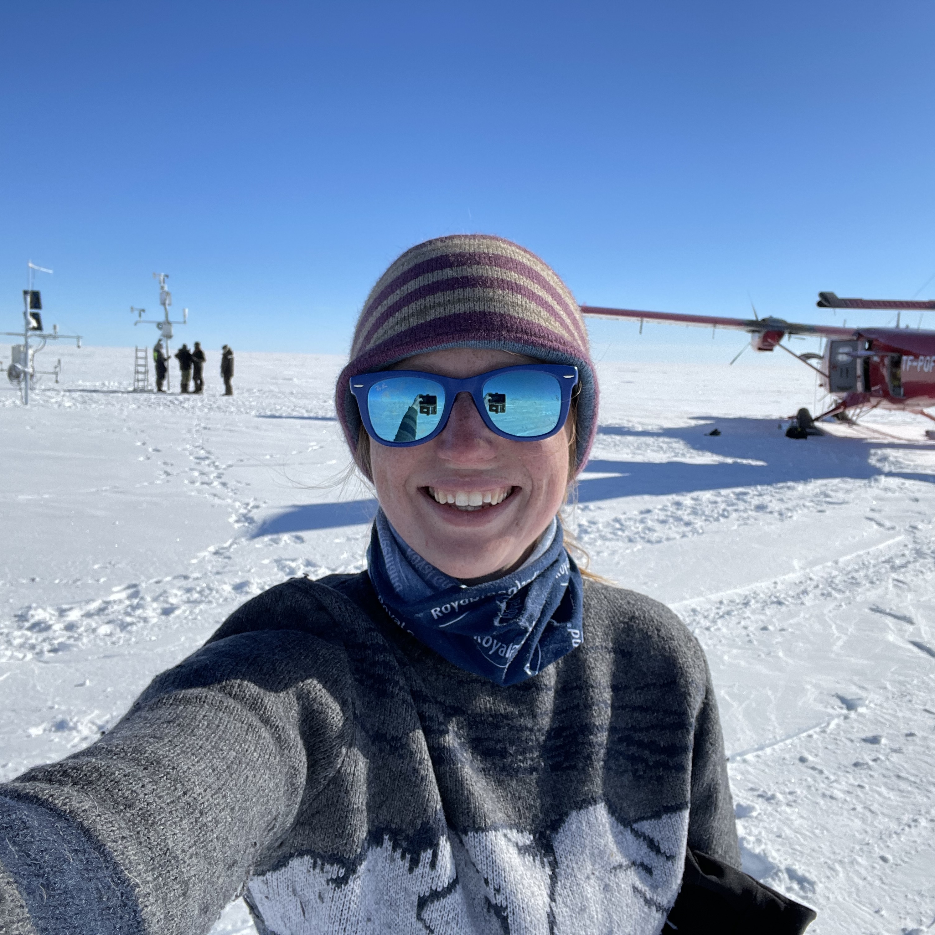
This month I have been in Svalbard, demonstrating on the Glaciology course (AG-325/825) at the University Centre in Svalbard (UNIS). The course is aimed at Masters and PhD students who want a taste of the Arctic. The course consists of four weeks of glaciology lectures and weekly excursions to glaciers in the local area. I have been supporting the logistical side of the weekly excursions, with the odd bit of teaching here and there. This week we have been to Paulabreen, a surge-type glacier, which has some impressive ice exposures.
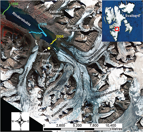
Map of Paulabreen, which flows into Rindersbukta, along with Skobreen and Bakaninbreen. The camera labelled on the map is the location of a time-lapse camera installed by researchers at UNIS, which captured the 2003-05 surge of Paulabreen-Skobreen. Source: Kristensen and Benn (2012)
Paulabreen is a tidewater glacier that calves into Rindersbukta, a sheltered embayment that is situated close to the small mining settlement called Svea. Bakaninbreen and Skobreen are tributary glaciers of Paulabreen. All three of these are a special type of glacier called *surging glaciers*. A surge-type glacier is classified by its inability to transfer its mass from the upper accumulation region to the lower ablation region in a steady way. In the quiescent phase of a surge, ice accumulates over time with slow throughput to the front (i.e. low velocities). At a given threshold, the glacier switches and rapidly transfers this large reservoir of accumulated ice, surging forward with velocities up to ten times faster than its slower, inactive phase. To find out more about surging glaciers, why they surge and where they can be found, I recommend reading a series of papers by Heidi Sevestre, whose PhD was specifically looking at surging glaciers - cataloging where they are, and producing a new concept that explains the processes behind surging dynamics.
Paulabreen and Skobreen last experienced a surge from 2003-2005, which was beautifully captured in this time-lapse sequence. The surge initiated at Skobreen, dragging Paulabreen with it as it propagated down into Rindersbukta. Over its surge period, these two glaciers advanced 2800m, with an average velocity of 3.2 m per day. For more information on the Paulabreen-Skobreen surge, click here.
Currently Paulabreen is very slow-moving and experiencing a steady retreat. The position of the glacier front is similar to its position in the 1980s, having advanced and retreated between then and now. Observations from the time-lapse sequence of the surge shows that the ice experienced thrusting and severe ice deformation, which is still seen in the ice today. By examining the ice exposures at the front of Paulabreen, we can get up close and personal to the processes that occurred during its surge phase. There are several features of interest that we could see...
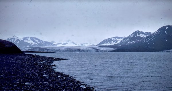
Paulabreen in 1982. Photo credit: Simon Collins @RGSweather
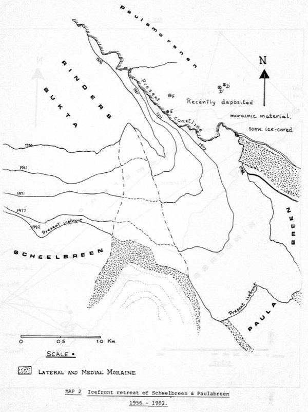
Map of Paulabreen in 1982. Credit: Simon Collins @RGSweather
Summary of the survey of Paulabreen in 1982. Credit: Simon Collins @RGSweather
*Many thanks to Simon Collins (@RGSweather) for sharing his amazing photos and information about Paulabreen in the 1980s. Simon was part of an expedition who surveyed Paulabreen and Vallakrabreen, also taking sediment samples, weather readings and collecting information on the flowering species Alpine Bistort. The expedition consisted of a week-long hike from Longyearbyen to Svea, and then taking small boats across Rindersbukta to the study area. They spent six weeks there in total.*
*Check out RGSweather for information on the Reigate Grammar School Weather Station, an automated weather station which collects high-resolution data on temperature, rainfall, barometric pressure, humidity, wind speed, wind direction and sunshine hours in the south of the UK. RGSweather are particularly dedicated to stimulating interest in the weather, with regular blog posts and information.*
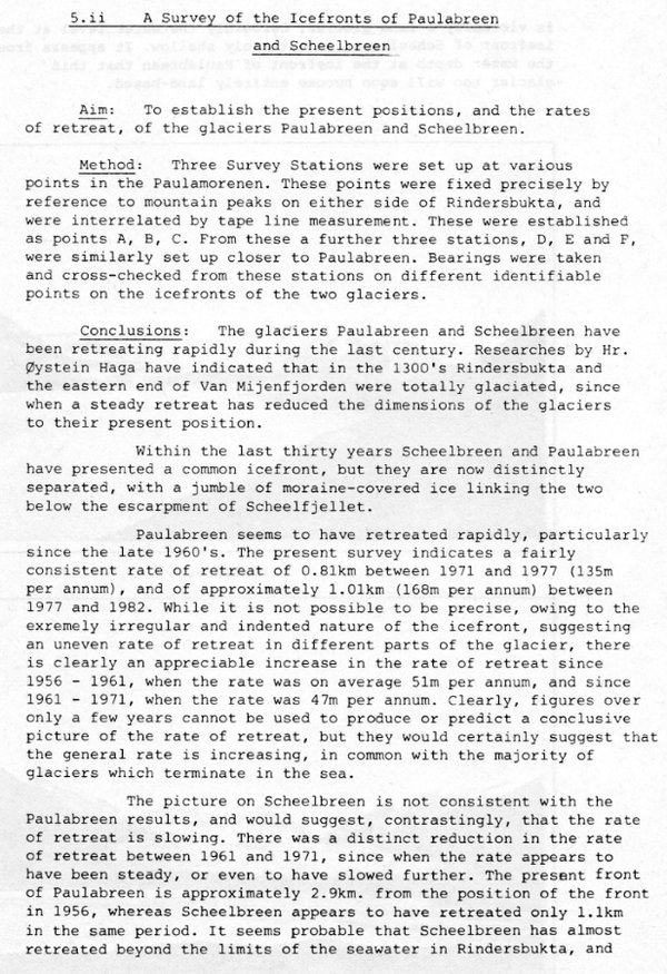
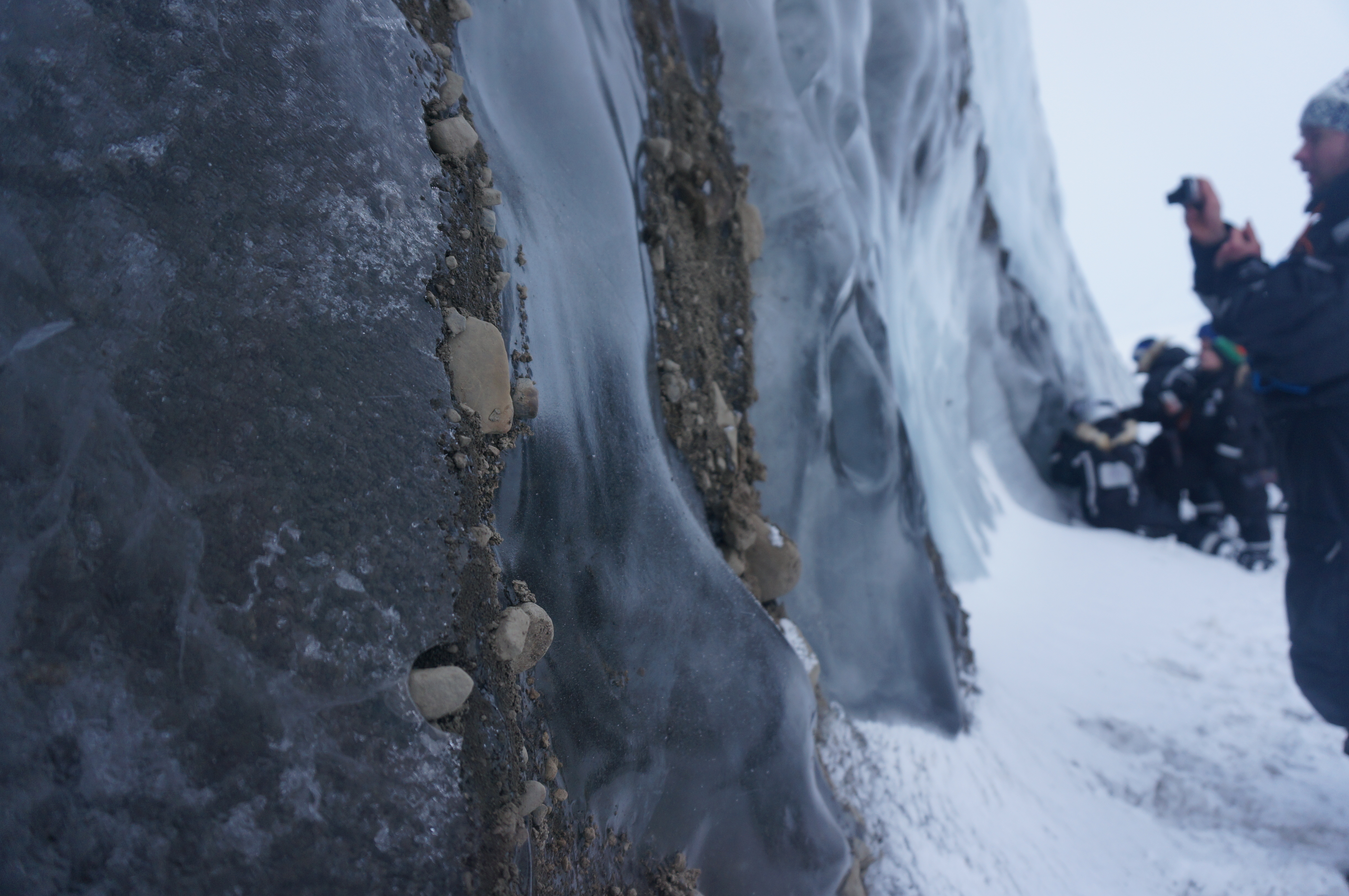
A section of Paulabreen’s calving front with glaciology students on snow scooters for scale (March 2016)
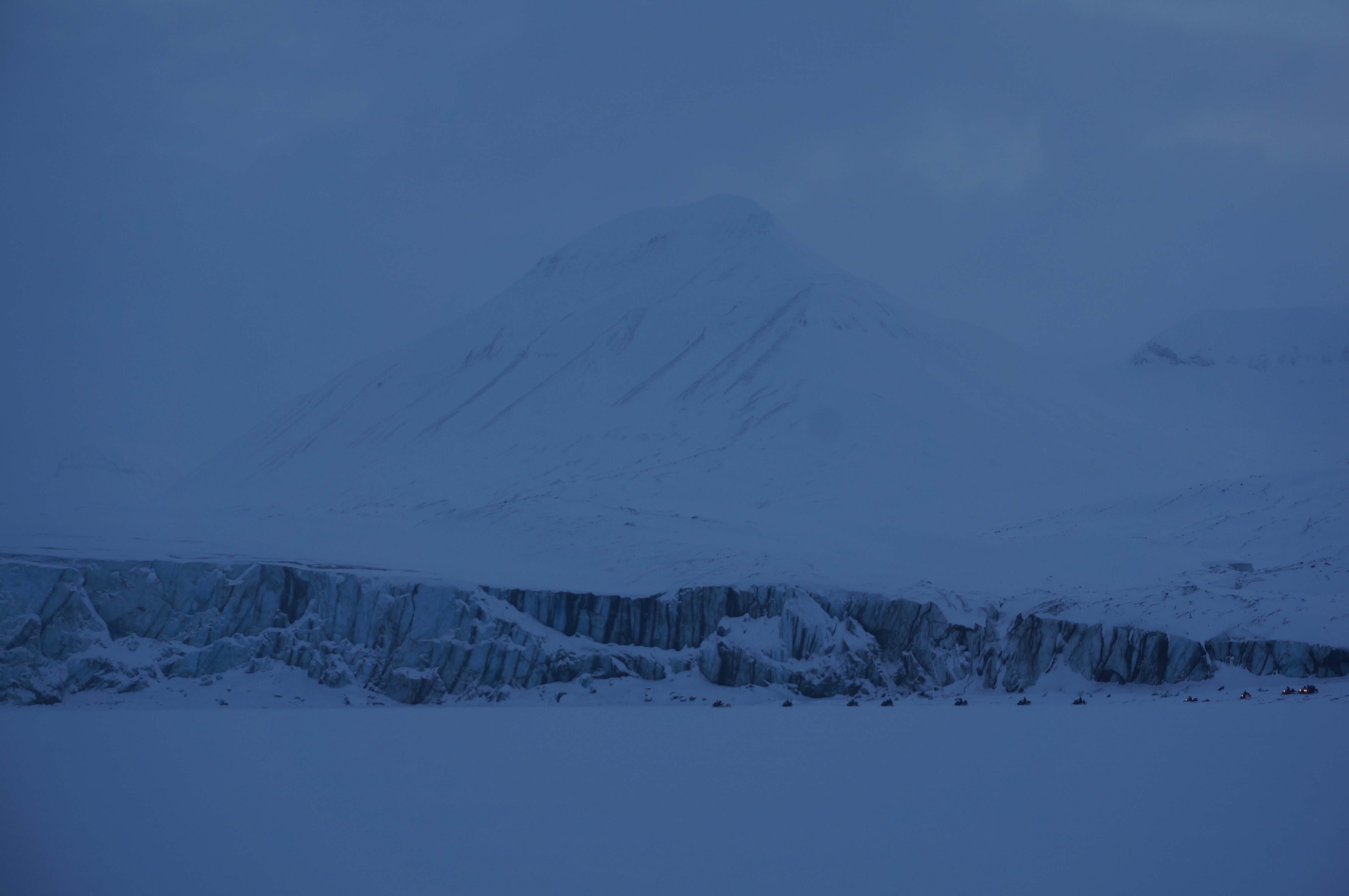
Glaciology students examining the ice exposure at west side of Paulabreen (March 2016)
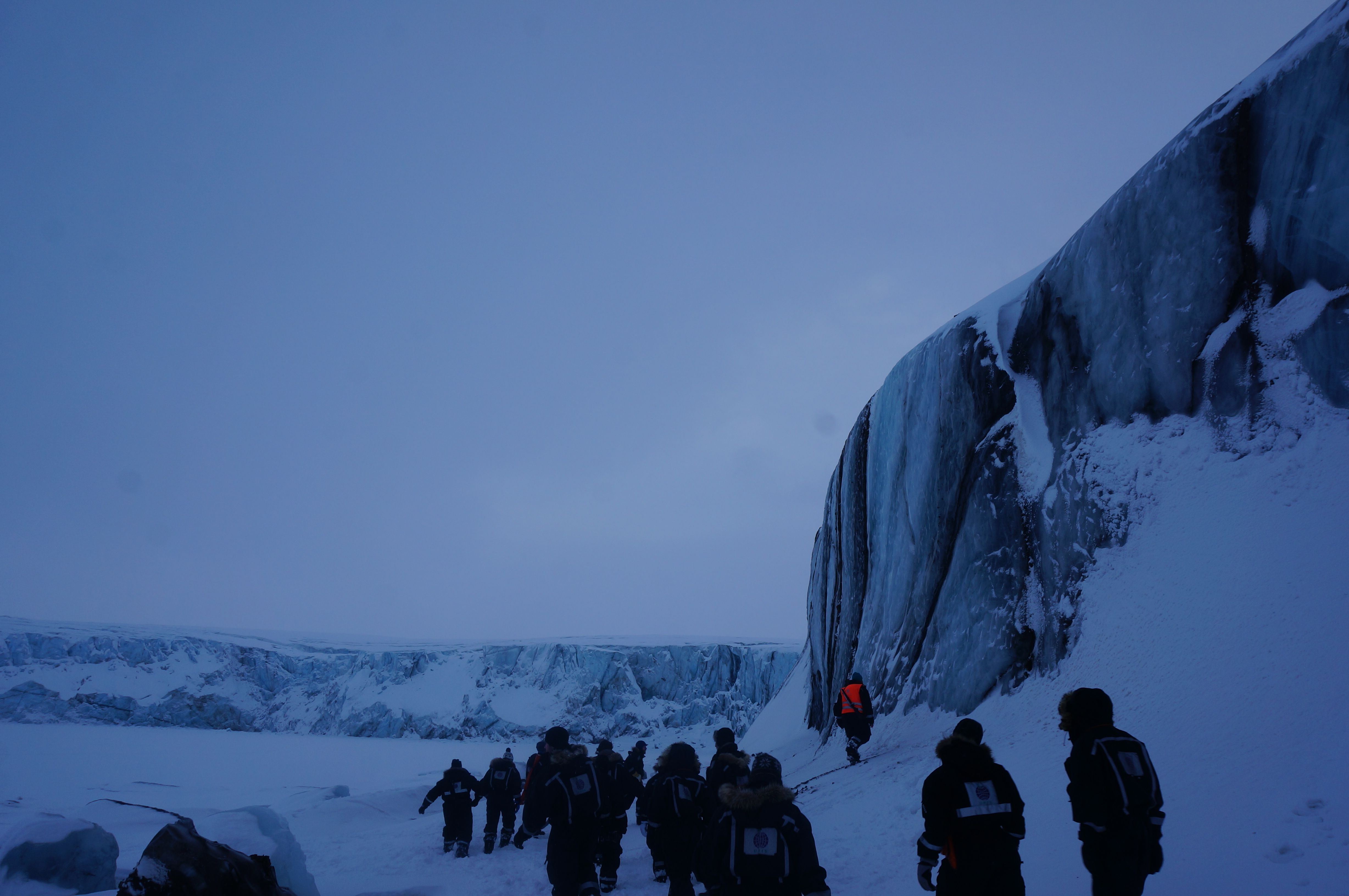
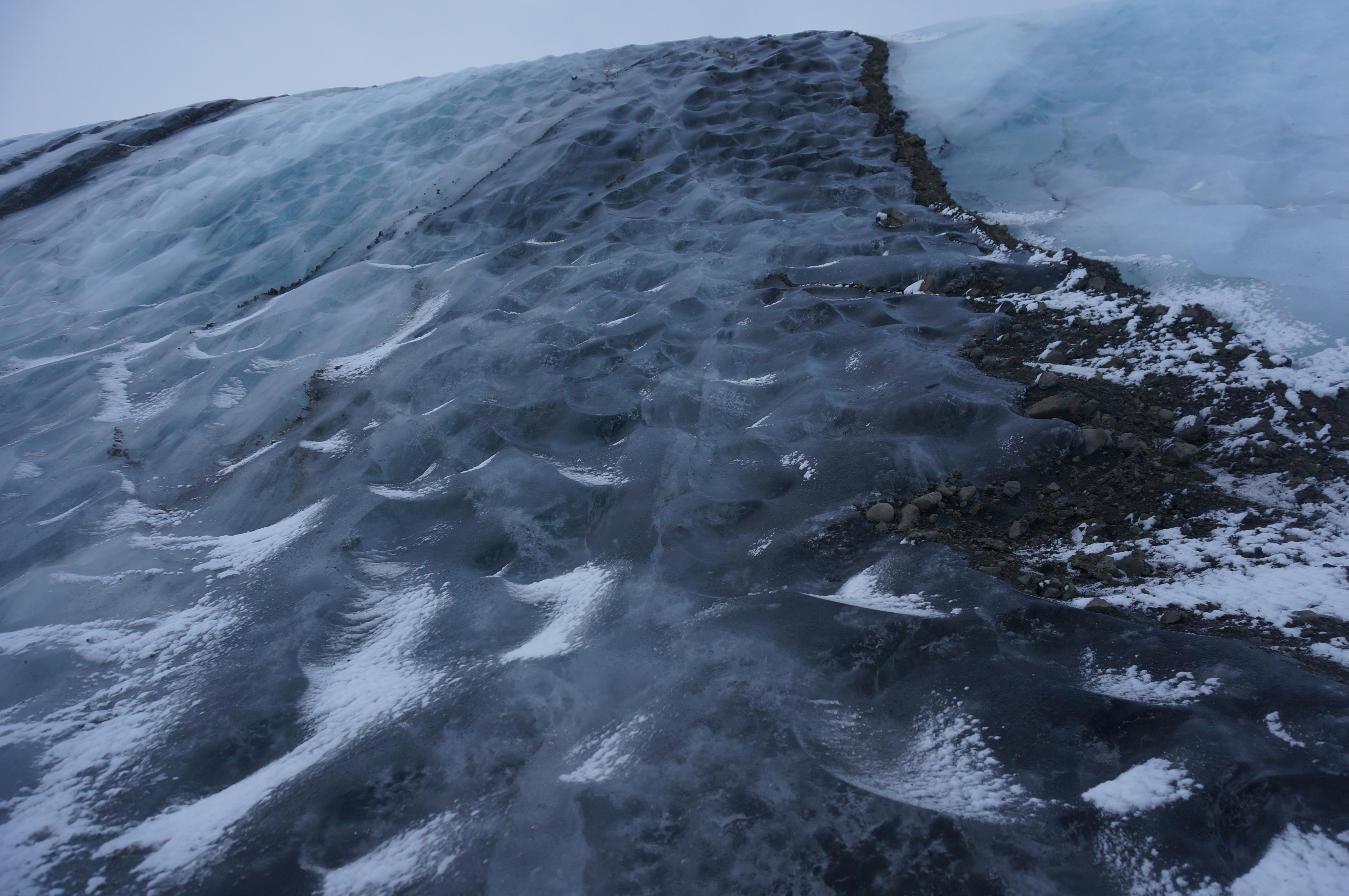
Glaciology students studying a section of the ice exposure at Paulabreen. The section here is approximately 6 m high (March 2016)
Wind pockets. High-winds exploit small indentations in the ice, creating hollows in the ice face. This process is not associated with the surge at Paulabreen, but is commonly seen at ice faces all over the world.
Wind pockets at Paulabreen (March 2016)
Wind pockets at Paulabreen. This picture shows approx. 15m ice face (March 2016)
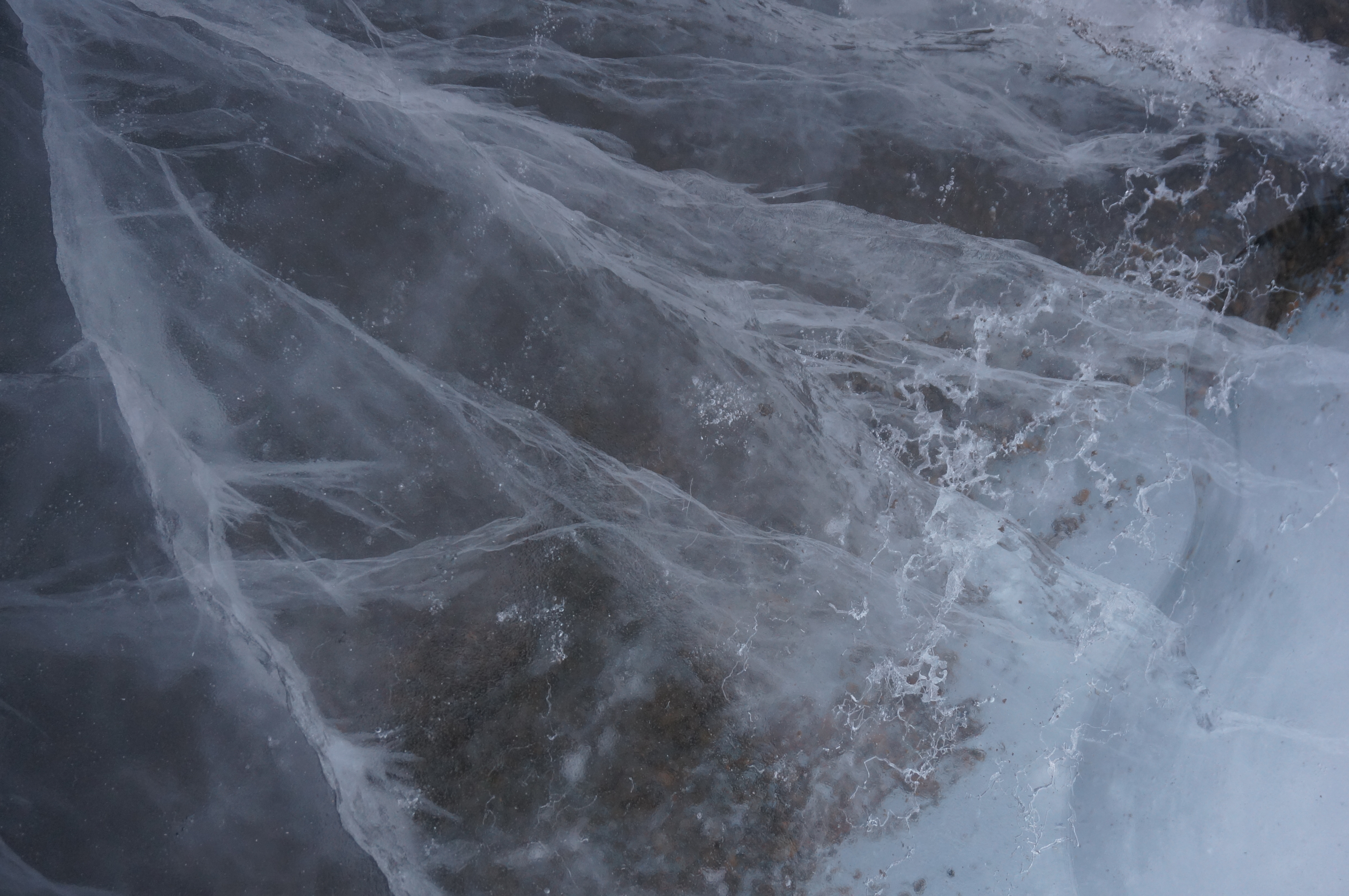
'Wormy' ice. When ice is warmed by rapid motion, it partially melts. This allows air to move around the ice. It often travels towards ice crystal grain boundaries. This creates the 'worm'-like veins in the ice. .
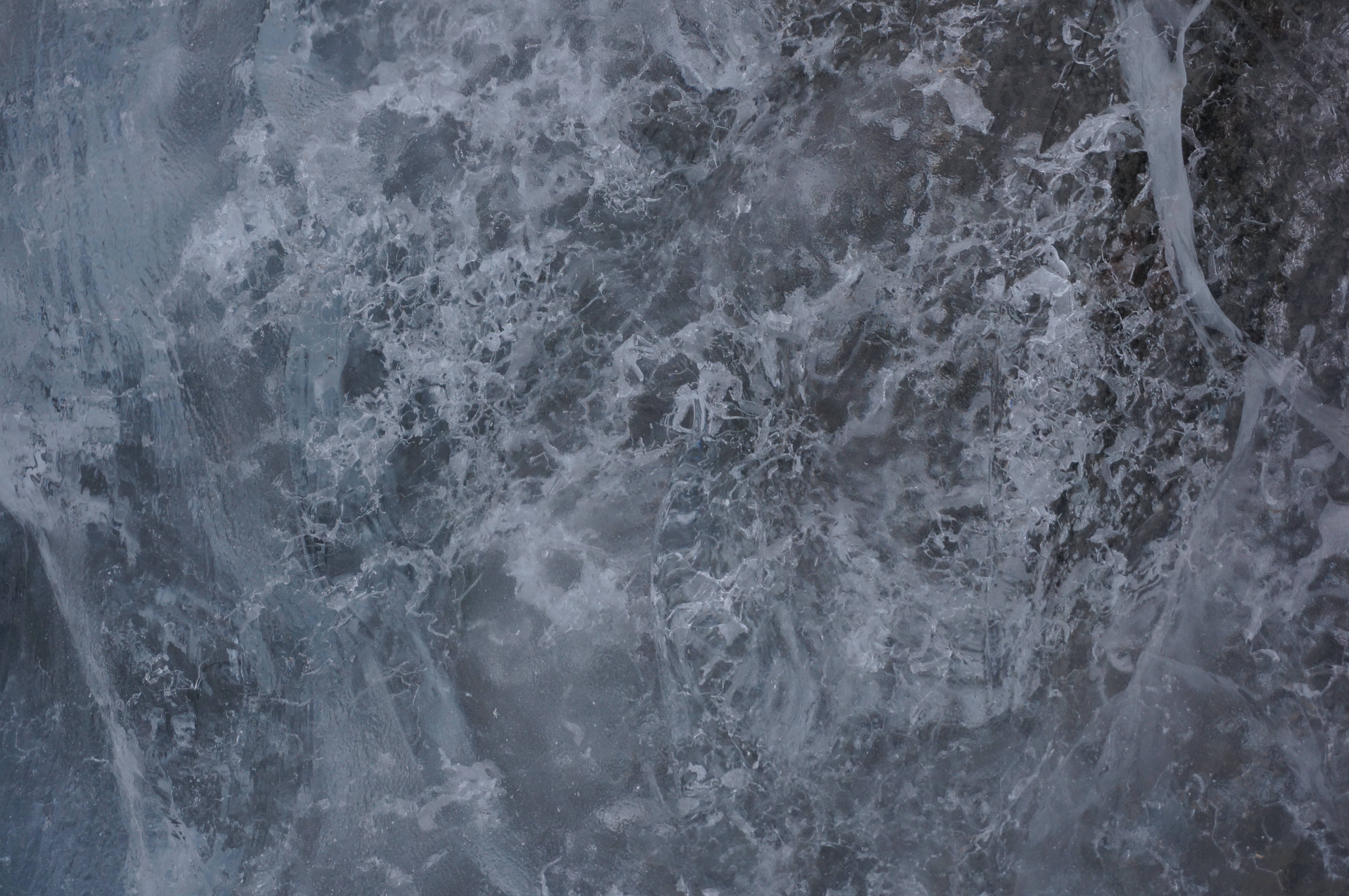
Wormy ice at Paulabreen. The section shown here is approx. 0.5 x 0.3 m (March 2016)
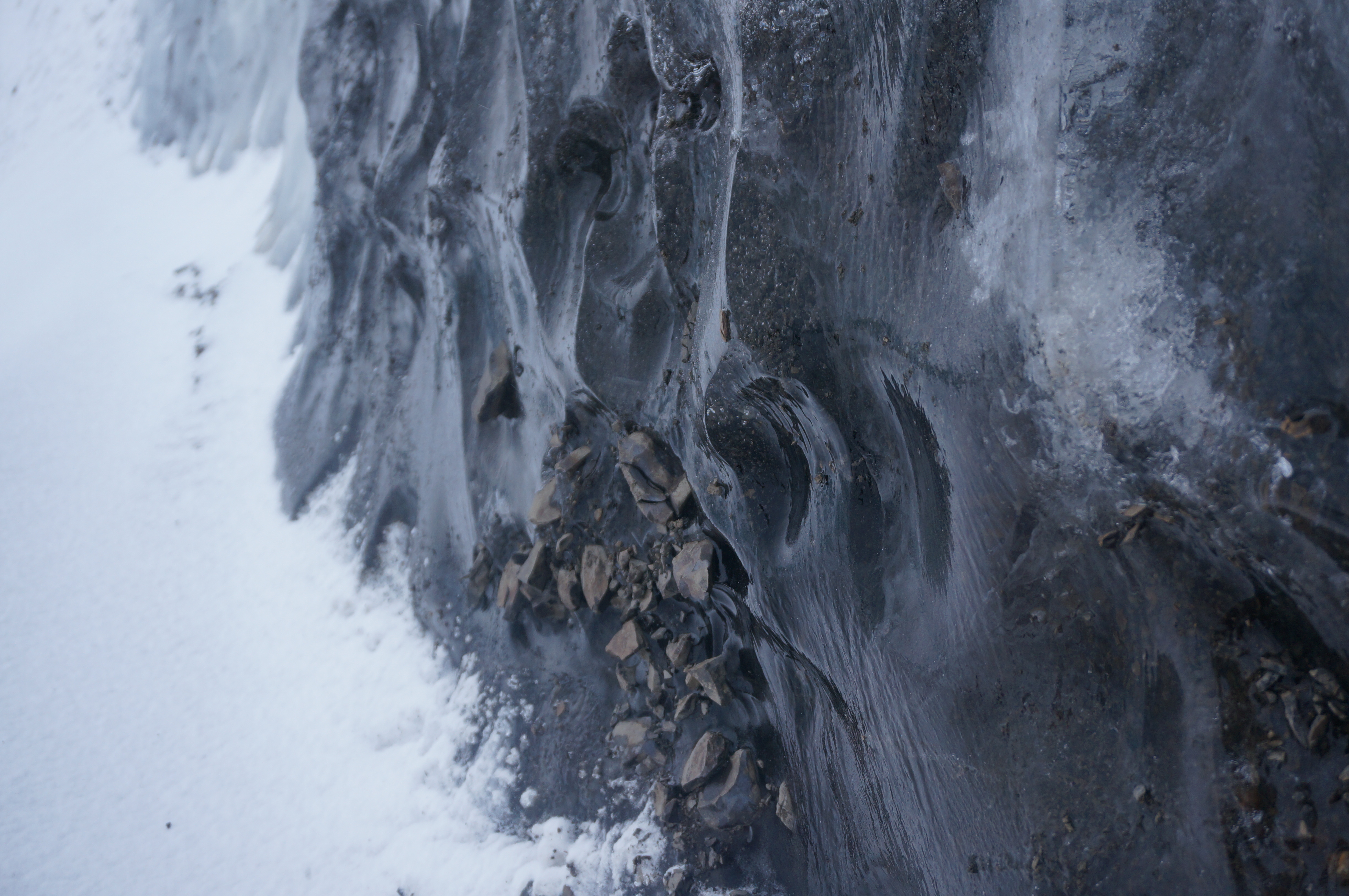
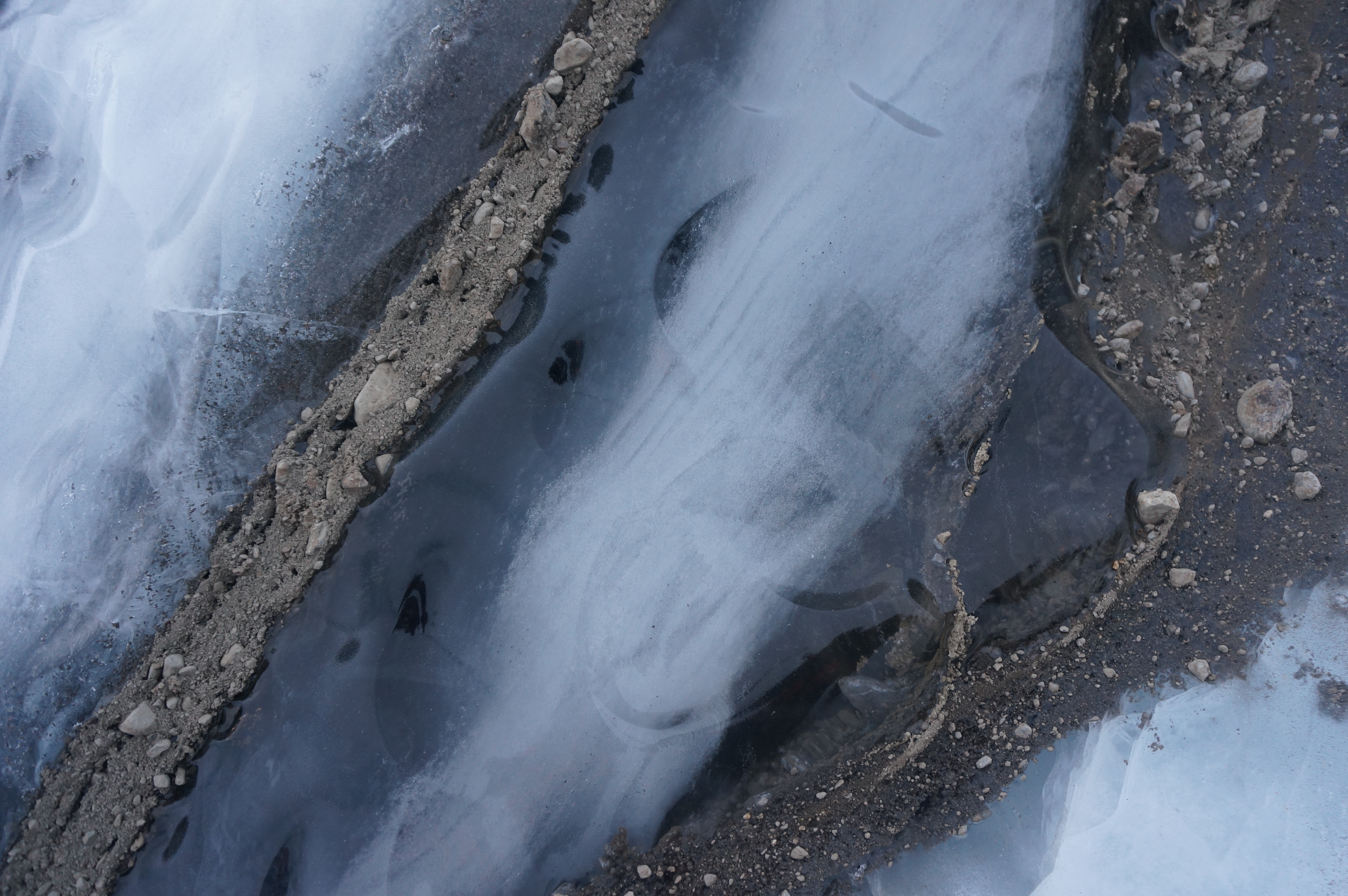
Regelation ice. Ice under a high amount of pressure, squeezing all air out of it to create very clear ice. Regelation ice can form at the bed of a glacier (in a high-pressure environment) or can form when exerted under high pressure. This changes the melting point of the ice and allows it to be partly liquid. During the surge at Paulabreen, sections of ice were pushed on top of one another, creating high amounts of pressure and liberating the air from the ice.
Regelation ice (left) and meteoric ice (right) separated by a layer of debris at Paulabreen. Meteoric ice refers to ice derived from precipitation. Regelation ice is modified meteoric ice, transformed in a high-pressure environment. The section here is approx. 2 x 1.5 m (March 2016)
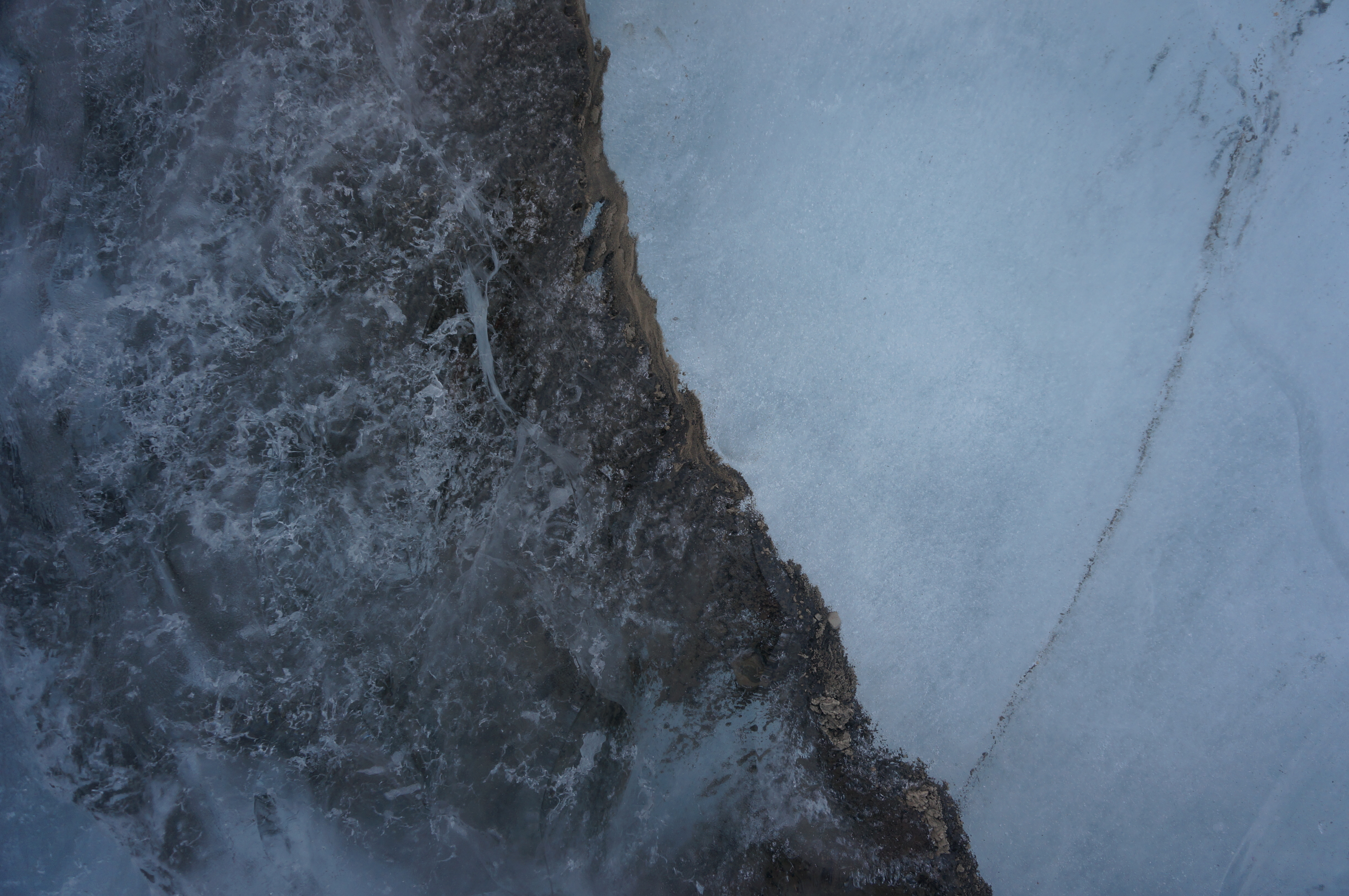
Debris entrainment features. Debris (i.e. fine-grained sediment, small pebbles, rocks) is often found in glaciers. This can be inputted on the glacier surface via rock fall and washed into surface meltwater channels. It can also be introduced at the base, entrained as the glacier ice flows over the bed. The size, texture and orientation of the debris entrainment can tell us about its origin and entrainment mechanism. At Paulabreen, we see a lot of angular debris bands, with small pebbles orientated in the same direction. In this case, the debris has been entrained from the bed as one ice section has thrust over an adjacent stationary section during the 2003-05 surge.
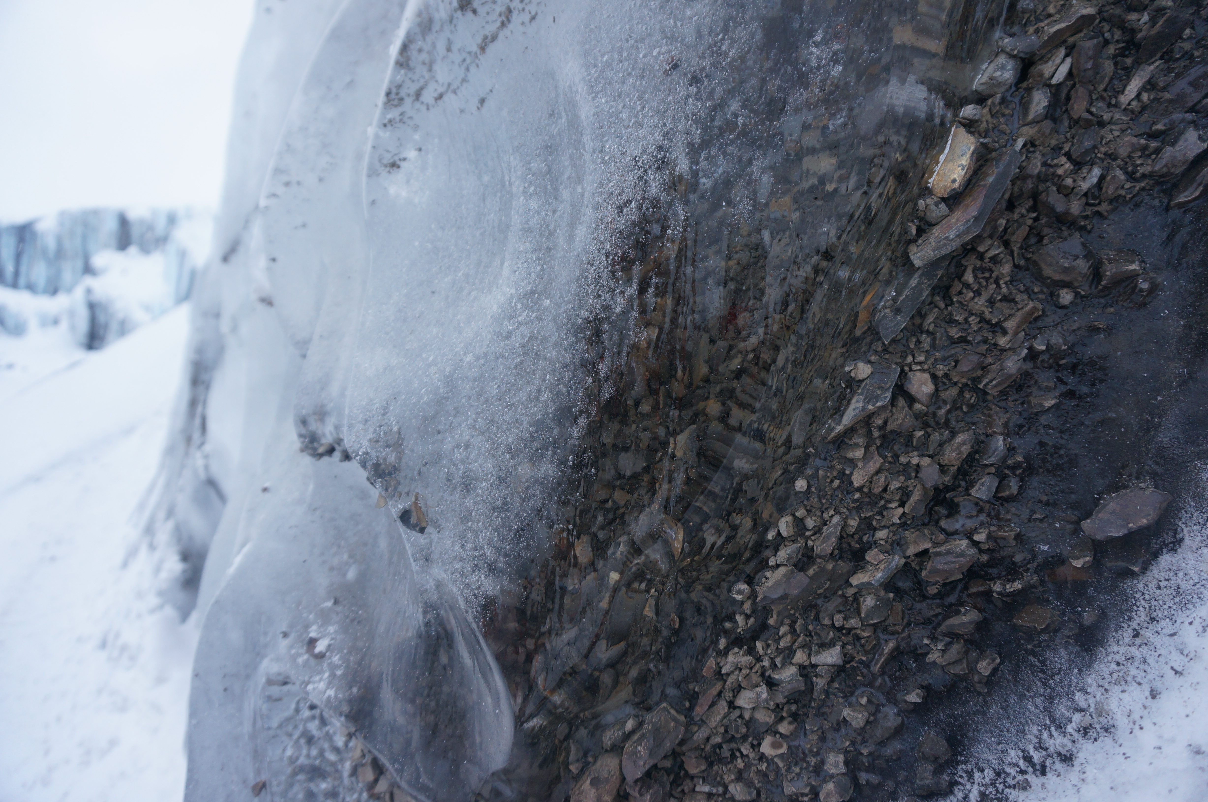
Entrained debris at Paulabreen. This debris band extends to the top of the ice face, with small angular pebbles all orientated in the same direction. This was formed during the surge phase of Paulabreen (March 2016)
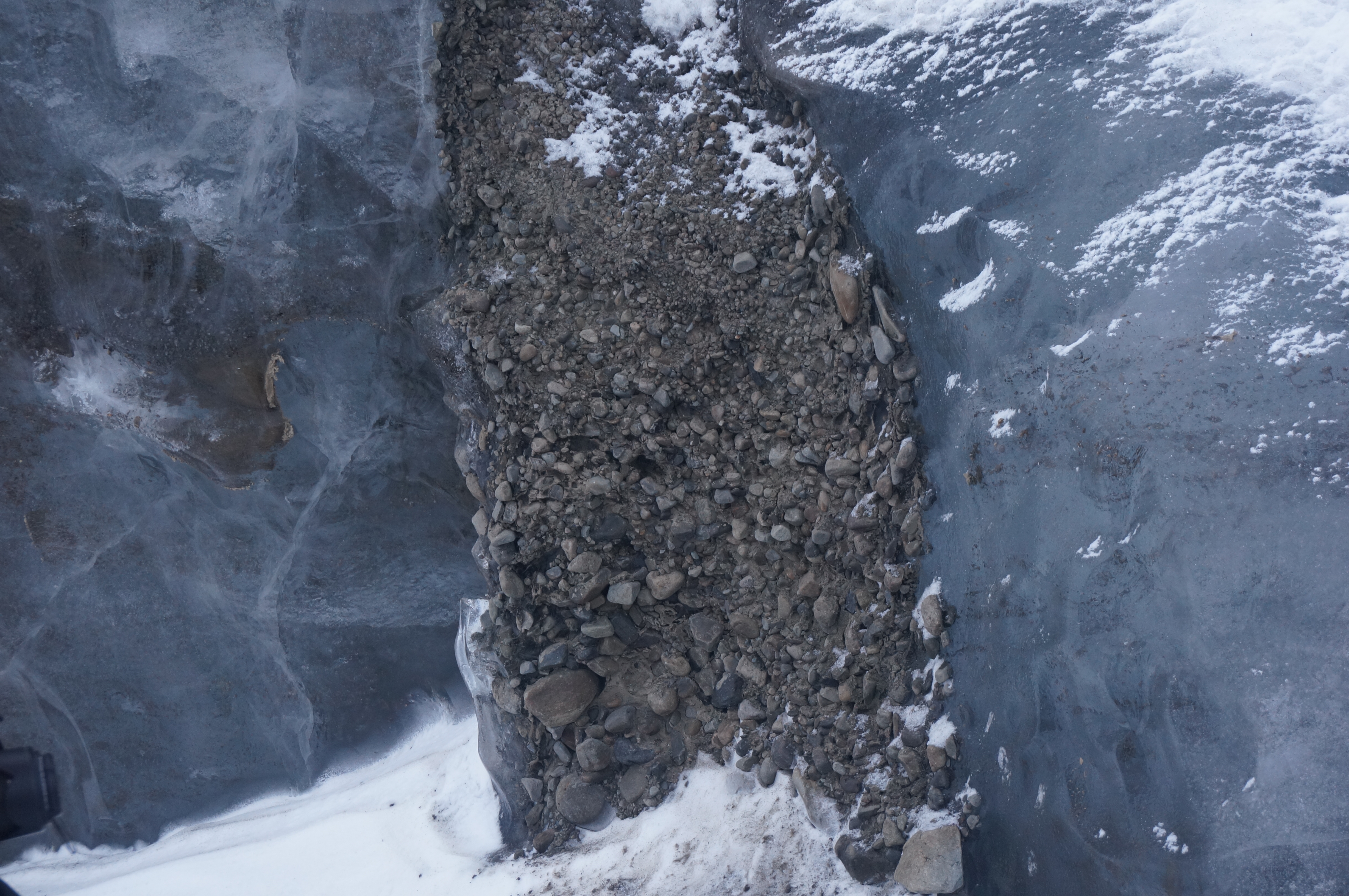
Debris squeeze feature at Paulabreen. The debris here is rounded and sorted, with finer sediment at the top of the feature and larger pebbles and rocks at the bottom. In this case, crevasses and cracks appear at the base of the glacier as it surges rapidly. A slurry of wet mud and stones is then forced into these under the pressure exerted by the weight of the glacier. The debris squeeze feature shown in this image is approx. 3 x 0.5 m (March 2016)
Debris - Regelation ice - Meteoric ice patterns. During the surge of Paulabreen, multiple sections of ice were thrust over each other as the ice was being pushed down Rindersbukta. This created a distinct pattern of debris band, regelation ice and meteoric ice. There is a gradual transition from the regelation ice to meteoric ice, from less bubbly to more bubbly ice. Where the debris passes over the ice, there is a sharp transition from meteoric ice to debris. As a section of ice is thrust over another, debris is entrained from the bed. This creates the debris band. The process of thrusting generates a large amount of pressure that transforms the ice immediately adjacent to the bed into regelation ice. This creates the seciton of regelation ice. On top of this regelation ice is normal unmodified meteoric ice, which has not been subjected to high pressure conditions. Over the period of the surge, multiple ice thrusting events create multiple lines of debris, regelated ice and meteoric ice.
Debris-Regelation ice-glacier ice patterns seen at Paulabreen. The section here is approx. 3 x 2 m (March 2016)
Debris-Regelation ice-glacier ice patterns seen at Paulabreen (March 2016)
Internal ice fractures. Cracks or faults in the ice that relate to cooling of the ice as it meets relatively cold winter air temperatures, and strong pressure gradients near the free ice face. These features are not directly related to the surge of Paulabreen.
Ice fracturing at Paulabreen. Image here shows 1 x 0.6 m section of the ice exposure (March 2016)